non standard maps
1958
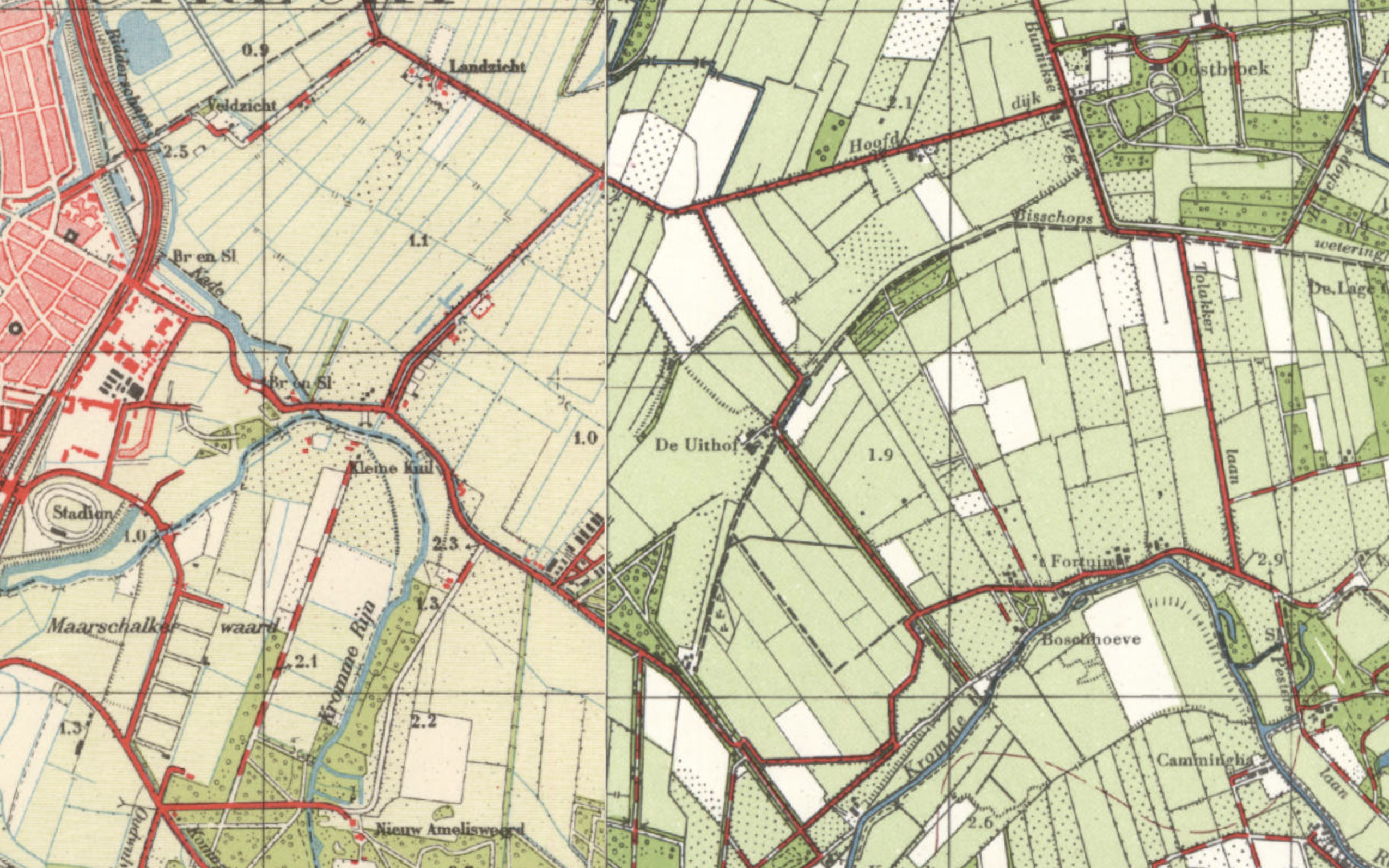
This map is © topotijdreis.nl. 1958 is the year that the Dutch cabinet agreed on the acquisition of the 'Johannapolder' for Utrecht University. At the time, the name 'De Uithof' is only in use for the farm in the middle of the map. The Johannapolder is almost completely without buildings. On the map we see a historic waterway 'Bisschopswetering' running from Oostbroek to farm De Uithof. This waterway was abolished in the early days of building in De Uithof. Next to the triangular wood ('Hoge Bos', still existing) the map shows a number of buildings grouped together with some roads. This is is odd because they are the barracks of 'Kamp Rhijnauwen' (1945-1948) which was used as internment camp after WWII for NSB members (those who had sympathised with the nazis). One of the few that published on this camp is Jim Terlingen. (Dutch)
1970
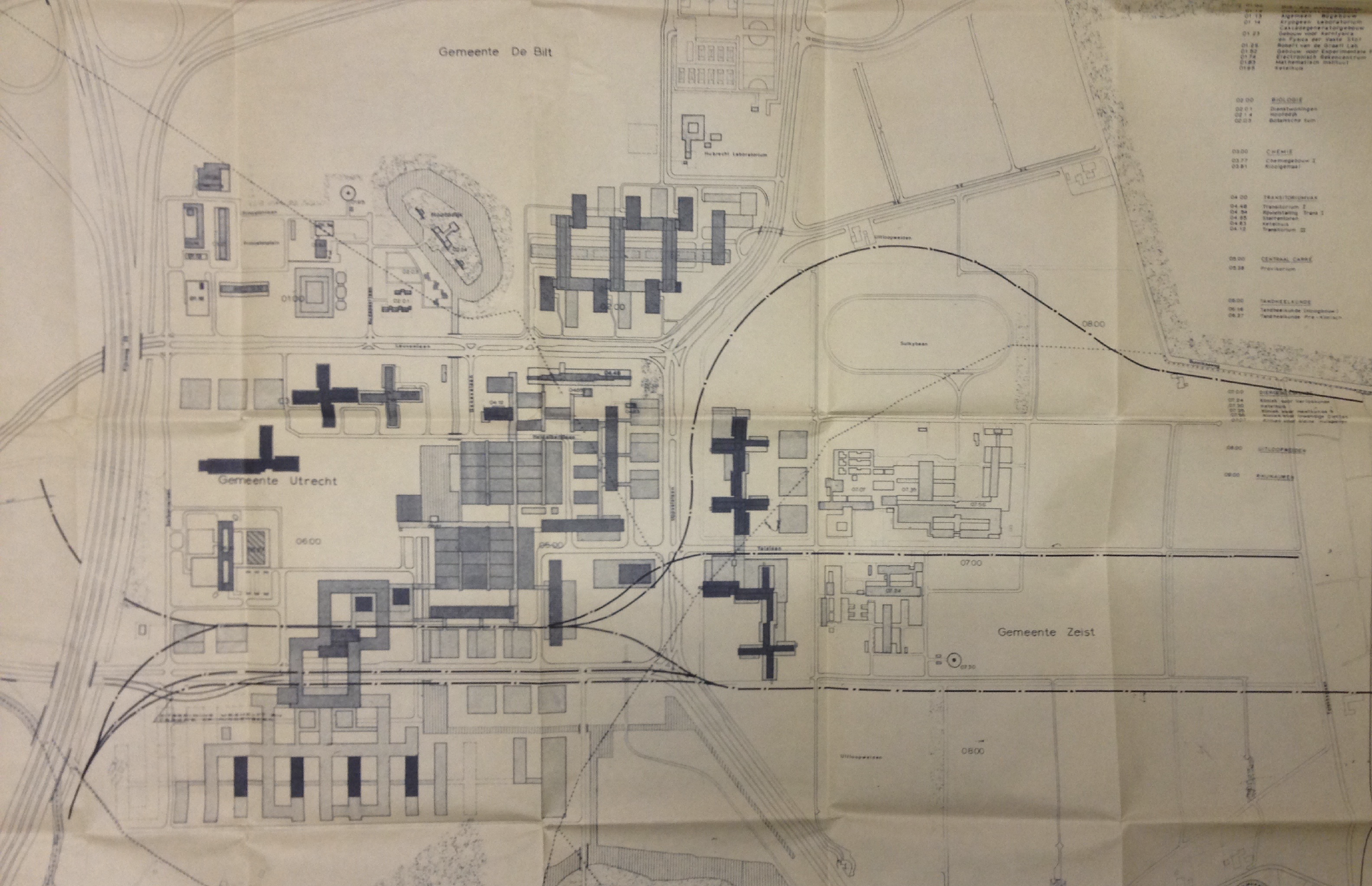
In May 1970 the university published a study into the possibilities of railway traffic to the area. This map illustrated the possible locations for the railway tracks. They aimed at realisation around 1985 to serve 10.000 employees and 25.000 students. On this map, the medical cluster is positioned at the south west of De Uithof. We see suggestions for a connection to Zeist as well as Bunnik.
1970
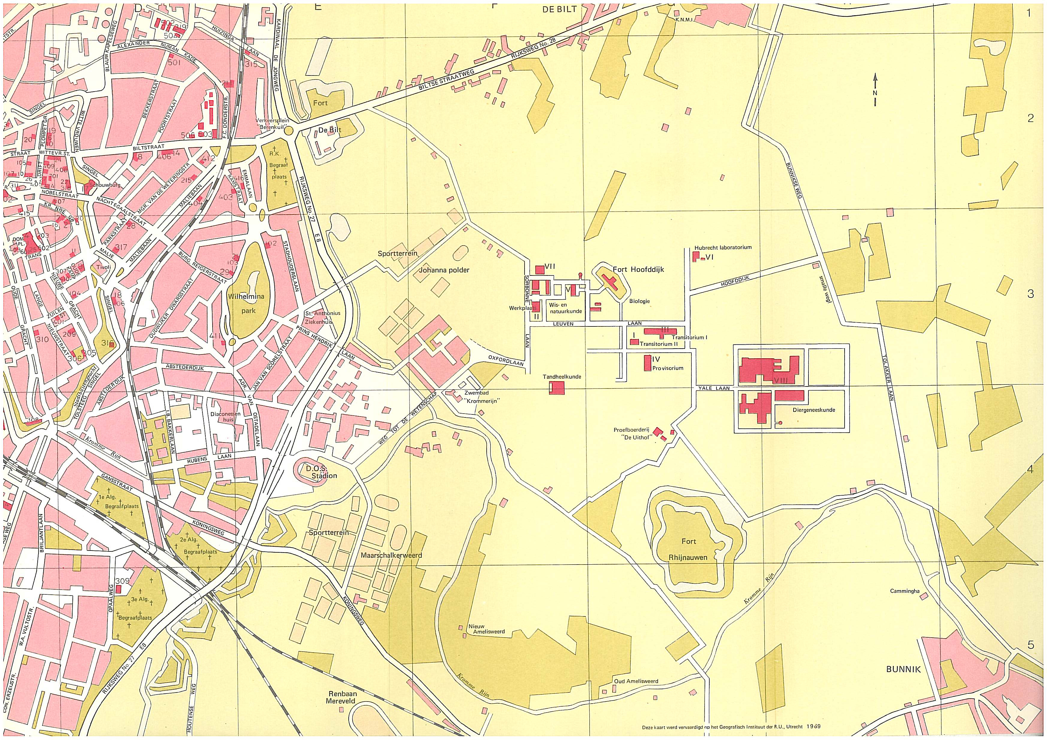
After ten years of building in De Uithof the map above shows the way that the new grid was superimposed on the area without respecting the underlying landscape. Striking, with present day eyes is the absence of both motorways A-27 and A-28. The Oostbroekselaan, connecting Fort De Bilt and the Sorbonnelaan, was still intact.
early 1970s
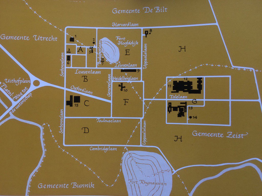
This map clearly shows the 4 municipalities which originally had jurisdiction over De Uithof area. Note that the present 'Toulouselaan' was named 'Cambridgelaan' here, whereas it would take until the mid nineties for the present Cambridgelaan to be built. Uppsalalaan still included (part of) the present Universiteitsweg and Bolognalaan. In a world prior to the motorways, a roundabout ('Uithofplein' = Uithof Circle) was conceived as the central connection to Utrecht city.
2006
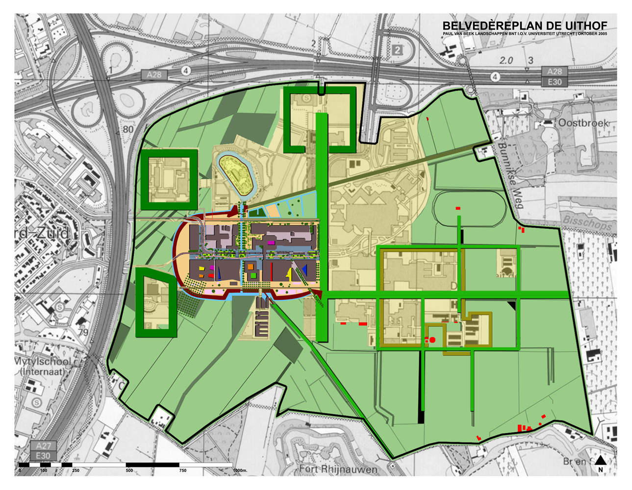
Paul van Beek Landscaping was commissioned by the university to develop a masterplan to complement the urban design by Zaaijer / Koolhaas. The university decided not to adopt this Belvedere plan.
2011
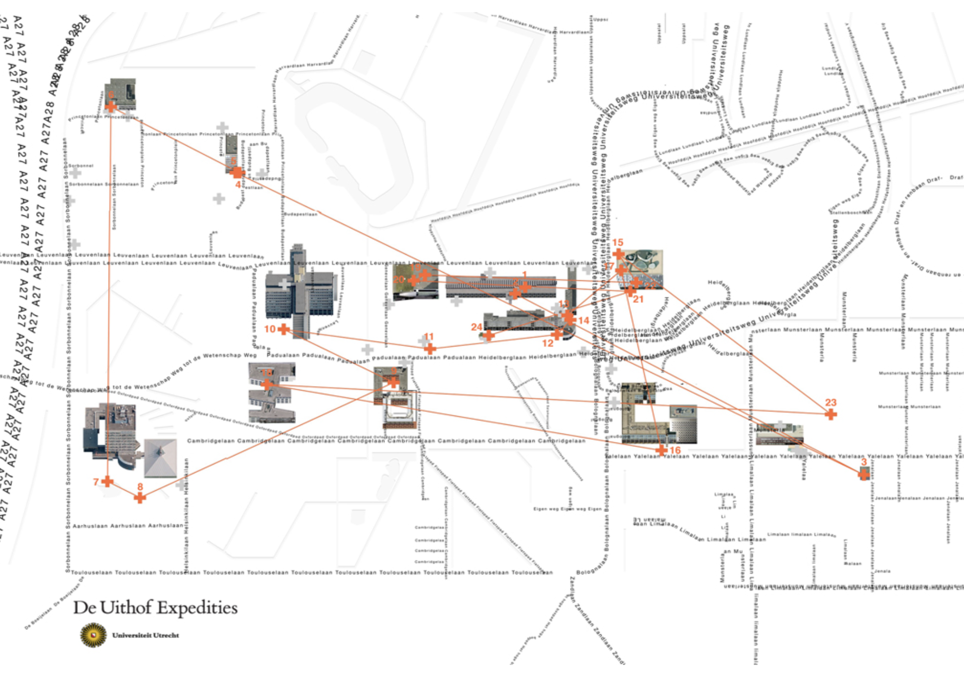
In cooperation with the Utrecht University and together with designer Henriëtte Waal and Koehorst in 't Veld, Studio Makkink & Bey has put together a series of walks through the Uithof campus area under the collective name 'De Uithof Expedities' (the Uithof expeditions). De Uithof Expedities is a conceptual work of art that does not present itself autonomously in public space, but serves the public in the form of walks, a website, a knowledge network, a collection of benches and a collection of mugs. The original idea was that the work of art expands by using it bmo uploading photo's to Flickr.
The first (and only) walk, is the art route (the map above). It was realised on campus. It aims at showing the works of art that were commissioned in or near buildings on the basis of the so called 1% measure (1% of building cost devoted to art). A second walk, relating to the 'tankgracht' of the Nieuwe Hollandse Waterlinie, was designed, but not executed.
2016
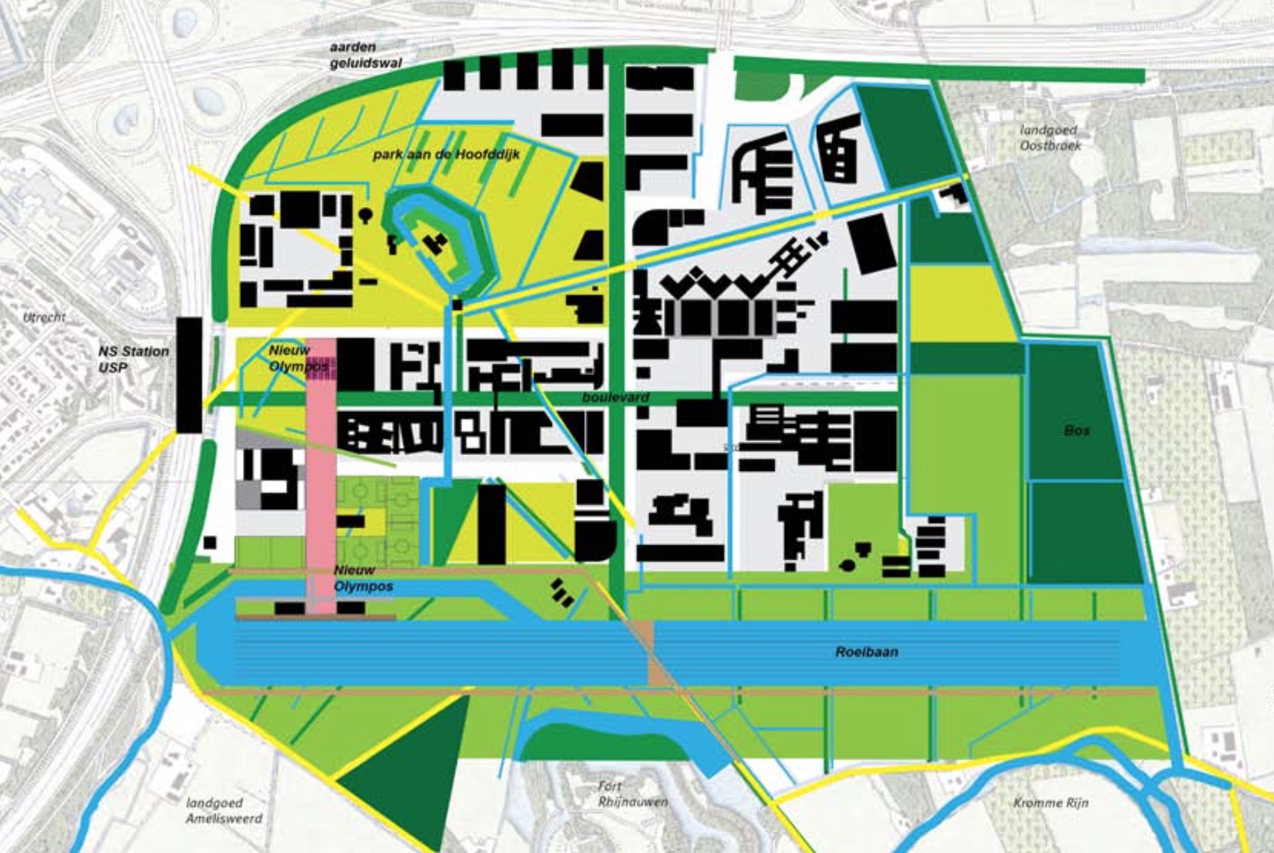
Many are inspired by De Uithof. On personal title Wim Bouwhuijzen took quite some effort to draw up what he considered to be a possible and sustainable future Uithof. He coined his plan Uithof 3.0. It can be read full text at the ISSUU platform. We see a railway and train terminal on top of the motorway A-27, a 1.500 mtr rowing course south of the Toulouselaan. Digging this rowing course frees 1 million cubic meters of ground, which, according to Bouwhuijzen should be reused locally in a noise barrier along A-27 and A-28.